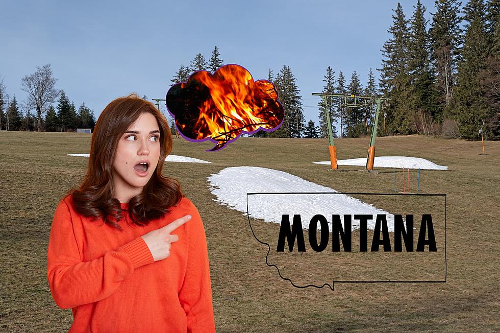
List of Wildfires Currently Burning in Montana [2021 Edition]
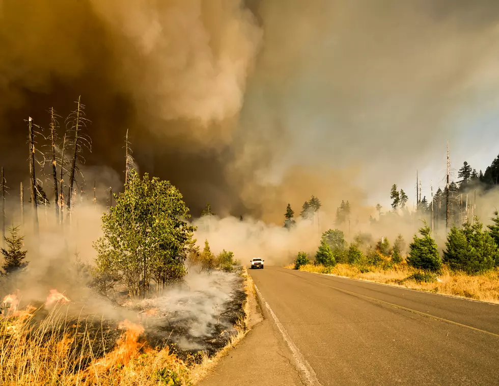
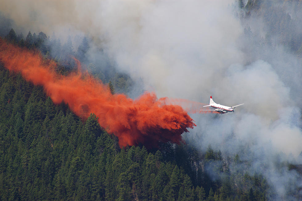
Wildfire season began quite a bit earlier than usual this year in Montana. Dry, drought-like conditions have resulted in multiple fires are wildfires burning throughout the state.
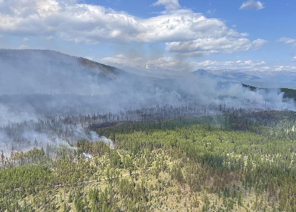
The largest wildfire burning in Montana is the Richard Spring Fire. The fire is burning in Rosebud County about 10 miles southwest of Colstrip, MT, Montana. The fire is currently 165,424 Acres. The fire was initially reported on August 8, 2021, and is still actively burning.
Fires Burning in Montana
Richard Spring Fire
- The Richard Spring Fire was identified on August 8, 2021, about 10 miles southwest of Colstrip, MT. Since then, it has burned along the Tongue River and has threatened multiple communities and infrastructure in the area. The fire jumped the Tongue River north of Ashland earlier this week, but firefighters are working to contain that spot fire with an indirect line. The cause of the fire is unknown at this time. The fire has burned 165,424 acres and is currently 0% contained.
Lame Deer Fire
- The Lame Deer Fire started August 10 west of Lame Deer, MT, and is currently threatening the town. Fire managers anticipate the fire will merge with the Richard Spring Fire. The fire has burned 3,884 acres and is currently 0% contained.
PF Fire
- The fire is burning six miles northeast of Hardin, Montana. The fire is currently 67,098 acres. The fire was initially reported on Tuesday, July 27, 2021, and is approximately 60% contained.
Boulder 2700 Fire
- The fire is burning in the Mission Mountains east of Flathead Lake, and eight miles east of Polson, MT. The fire has burned approximately 2,072 acres, and multiple structures have been lost. The fire's cause is under investigation. The fire is approximately 36% contained.
Trail Creek Fire
- The Trail Creek Fire started on July 8, 2021, approximately 20 miles West of Wisdom, Montana, as the result of lightning. 35,965 acres have burned and the fire is 26% contained. The estimated containment date is November 1, 2021.
Robertson Draw Fire
- The Robertson Draw Fire started on Sunday, June 13. The Robertson Draw fire is currently 29,885 acres, with approximately 90% containment. 47 personnel are working the fire. The Temporary Flight Restriction over the Robertson Draw Fire was lifted on July 27, 2021. The estimated containment date is Monday, November 1, 2021.
Harris Mountain Fire
- The Harris Mountain Fire started on July 23 approximately 10 miles southeast of Cascade, Montana. The fire was started by lightning. It has burned 31,591 acres and is approximately 52% contained. The estimated containment date is October 1, 2021.
Alder Creek Fire
- The Alder Creek Fire started on July 8, 2021, approximately 7 miles West of Wise River, Montana. Located on the Beaverhead-Deerlodge National Forest, the cause of the Alder Creek Fire has not been determined. The fire has burned 11,725 acres and is approximately 10% contained. The estimated containment date is Monday, November 1, 2021.
West Lolo Complex
- Thunderstorms on July 7, 2021, started multiple wildfires across the Lolo National Forest. U.S. Forest Service personnel and local firefighting crews actively engaged the fires. The western portion of the Forest, which includes the Superior and Plains-Thompson Falls Ranger Districts, experienced the most lightning activity. The West Lolo Complex includes the Thorne Creek Fire, near Thompson Falls, MT. The fire has burned 23,010 acres and is approximately 10% contained. The estimated containment date is Sunday, October 31, 2021.
American Fork Fire
- American Fork Fire started on July 17, 2021, in the northeast Crazy Mountains, 24 miles southwest of Harlowtown. It is one of several wildfires burning on the White Sulphur Springs Ranger District of the Helena-Lewis & Clark National Forest. The cause of the fire is lightning. The fire has burned 19,599 acres and is approximately 10% contained. The estimated containment date is October 15, 2021.
Gatlin Gulch Fire
- The Gatlin Gulch Fire is located approximately six miles SW of Boulder, MT. It was first reported on July 31, 2021, and is currently estimated at 60 acres and is 70% contained.
Goose Fire
- The Goose Fire started on July 1, 2021, 32 miles SSE of Ennis, MT near Hoodoo Pass. The fire has burned 7,522 acres and is approximately 90% contained. The estimated containment date is October 13, 2021.
Divide Complex-Balsinger Fire
- The lightning-caused Balsinger Fire started on July 8, 2021. It is burning 7 miles west of Neihart, Montana. The Balsinger Fire is being managed as part of the Divide Complex with the Ellis Fire. It is one of several wildfires burning on the White Sulphur Springs Ranger District of the Helena-Lewis & Clark National Forest. The fire has burned 9,834 acres and is approximately 45% contained. The estimated containment date is Friday, October 29, 2021.
Christensen Fire
- The Christensen Fire started on July 16, 2021, approximately 12 miles West of Wise River, Montana. The cause of the fire is unknown. It has burned 8,766 acres and is approximately 10% contained. The estimated containment date is Monday, November 1, 2021.
Deep Creek Canyon Fire
- The Deep Creek Canyon Fire started on Sunday, July 13, 2021, approximately 18 miles northeast of Townsend, MT. The cause of the fire is still under investigation. The fire burned 4,648 and is 98% contained.
Crooked Creek Fire
- The Crooked Creek Fire started on Tuesday, June 15, 2021, and is located 25 miles east of Bridger, Mont., in the Pryor Mountains. It is located in Carbon County near the southern boundary of the Crow Indian Reservation on the Custer Gallatin National Forest. The cause of the fire is unknown at this time. The fire has burned 4,141 acres and is approximately 85% contained. Firefighters will continue to hold and improve containment lines and continue point protection for values at risk.
Granite Pass Complex
- The Granite Pass Complex consists of four wildfires burning in the vicinity of Lolo Pass on the Nez Perce-Clearwater National Forests in Idaho and the Lolo National Forest in Montana.
- Shotgun Fire - The Shotgun Fire on the Powell Ranger District is located seven miles north of Powell Junction on Highway 12. It is on the Nez Perce-Clearwater National Forest.
- Boulder Creek Fire - The Boulder Creek Fire is 8 miles west of Lolo Pass Visitor Center. It is on the Nez Perce-Clearwater National Forest.
- BM Hill Fire - The BM Hill Fire is located ten miles north of Powell Junction and is burning on both the Nez Perce-Clearwater and Lolo National Forests. It continues to burn actively in heavy brush and timber. There are existing road and trail closures on both forests for public safety due to the BM Hill fire.
- Lolo Creek Fire, Missoula Ranger District - The Lolo Creek Fire is located between mile marker 1 and 2 along the Highway 12 corridor, approximately 1 mile west of Highway 12, and 1.5 miles northwest of the Lolo Pass Visitor Center on the Lolo National Forest.
The fires have burned 5,758 Acres and are 15% contained. The estimated containment date is Wednesday, September 15th, 2021.
Woods Creek Fire
- The Woods Creek Fire was discovered on Saturday, July 10 near Boulder Lakes in the Big Belt Mountains. The fire was started by lightning. Due to hazardous fire conditions in the Woods Creek Fire area, area and trail closures are in effect. Area closures have been implemented and close a large portion of the central Belt Mountains. The fire has burned 48,709 acres and is currently 5% contained.
Burnt Peak Fire
- The Burnt Peak Fire started by lightning on the morning of July 7 and was detected later that morning. It is burning approximately 9 miles southwest of Troy, Montana in timbered, steep terrain on the south face of Burnt Peak in the Keeler Creek Drainage. The fire has burned 3,583 acres and is approximately 46% contained. The estimated containment date is Thursday, September 30th, 2021.
Dry Cabin Fire
- The Dry Cabin Fire started on July 11, 2021. It is located in the Scapegoat Wilderness, Lewis and Clark County on the Lolo National Forest 20 miles north of Ovando, Montana. The fire was caused by lightning. The fire has burned 3,060 acres. The estimated containment date is Friday, October 15, 2021.
South Yaak Fire
- The South Yaak Fire was detected on July 13, 2021. It is burning in timbered, steep terrain approximately 4 miles northwest of Troy, Montana. The fire was caused by lightning. The fire presents a challenge due to steep terrain, difficult access, and critically dry vegetation. It is likely to burn until significant moisture covers the fire area. The fire has burned 10,498 acres and is approximately 44% contained. The estimated containment date is Wednesday, September 1, 2021.
Hay Creek Fire
- The Hay Creek Fire was first reported on Wednesday, July 21. It is located approximately 5 miles west of Polebridge, Montana. The fire has burned 2,894 acres and is 30% contained. There is no estimated containment date.
Divide Complex - Ellis Fire
- The Ellis Fire, which is being managed as part of the Divide Complex with the Balsinger Fire, started on July 8, 2021, on the White Sulphur Springs Ranger District of the Helena-Lewis & Clark National Forest. The cause is under investigation. The fire is located in the Dry Range - East Fork, about 2.5 miles southwest of Smith River. The fire has burned 1,277 and is approximately 80% contained. The estimated containment date is Friday, October 29, 2021.
Black Mountain Fire
- The lightning-caused Black Mountain fire was reported to the Dillon Interagency Dispatch Center on July 17, 2021. The fire is located 13 miles south of Jackson, MT, and east of Skinner Lake and Skinner Meadows. The fire has burned 1,042 acres and is approximately 75% contained.
Brewster Fire
- The Brewster Fire started on Thursday, July 8, and is located 4 miles east up the Brewster Creek Drainage, east of Rock Creek, and 8 miles south of I-90 on the Missoula Ranger District in Granite County. It has burned 156 acres and is approximately 85% contained.
Goat Fire
- The Goat Fire started on Saturday, July 17. It is located 16 miles west of Deer Lodge, Montana. It has burned 212 acres.
This list will be updated as more fires are reported throughout the state of Montana.
50 Famous Brands That No Longer Exist
See the Must-Drive Roads in Every State
More From My 103.5 FM