Winter Storm Watch Issued for Bozeman Wednesday Through Thursday
A Winter Storm Watch has been issued for Wednesday afternoon through late Thursday night.
According to the National Weather Service, a prolonged period of mountain and mountain pass snow is expected to impact areas along the Continental Divide, and Central and Southwest Montana from Wednesday night through the early morning hours on Friday.
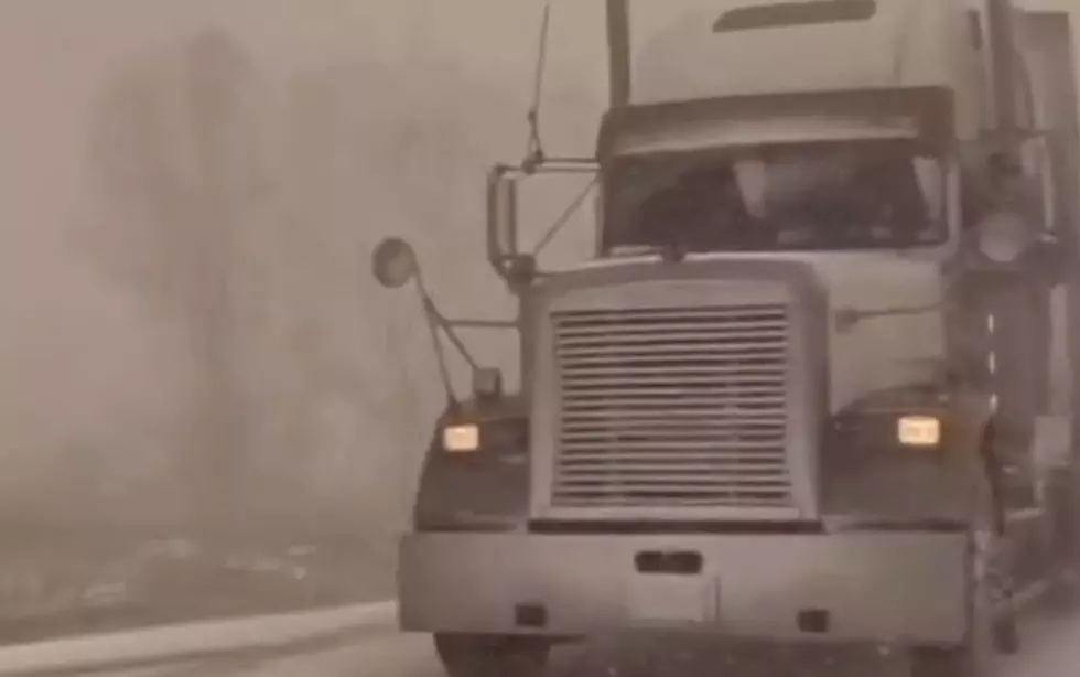
Snowfall could become heavy at times, especially during the day on Thursday, which could impact the morning and evening commutes. There remains some uncertainty with how much snow will accumulate during the day on Thursday at the lower elevations, but falling temperatures
Thursday night will likely lead to some accumulations over the plains and valleys of Central and Southwest Montana. In addition to accumulating snow, breezy and gusty winds could lead to blowing snow over mountain passes, which could significantly reduce visibility.
- Beaverhead-Cascade-Madison-Judith Basin-Broadwater-Meagher-Gallatin
- Including Big Hole Pass, Wisdom, Wise River, Kings Hill Pass, Raynolds Pass, Virginia City, Stanford, White Sulphur Springs, West Yellowstone, Battle Ridge Pass, Bozeman Pass, and Targhee Pass
WINTER STORM WATCH IN EFFECT FROM WEDNESDAY AFTERNOON THROUGH LATE THURSDAY NIGHT...
WHAT...Heavy snow possible. Total snow accumulations 6 to 12
inches between 4000 feet and 7000 feet, with 12 to 24 inches above
7000 feet. Winds could gust as high as 40 mph.
WHERE...Portions of central, southwest and west central Montana.
WHEN...From Wednesday afternoon through late Thursday night.
IMPACTS...Travel could be difficult. Areas of blowing snow could
significantly reduce visibility.
ADDITIONAL DETAILS...This Winter Storm Watch does not include
the cities of Great Falls, Townsend, or Dillon.
More From My 103.5 FM